Linear Park
The Linear Park Consultation; The current consultation process came about as a result of the NCH and members of the Residents Project Monitoring Committee and DCC in April 2018. The NCH had retained architects to design the plaza entrance to the hospital from the Rialto Luas Stop including the access point from the Fatima Luas Stop, the NCP agreed with DCC parks to jointly work on the process and it was agreed to use the Weaver Sq/Bridgefoot Street "model" to enrage with residents. It was also agreed that the brief should extend from the original of James Walk west to Suir Road and include the entire linear park.
TIME LINE: DCC CEO July 6th 2021 here
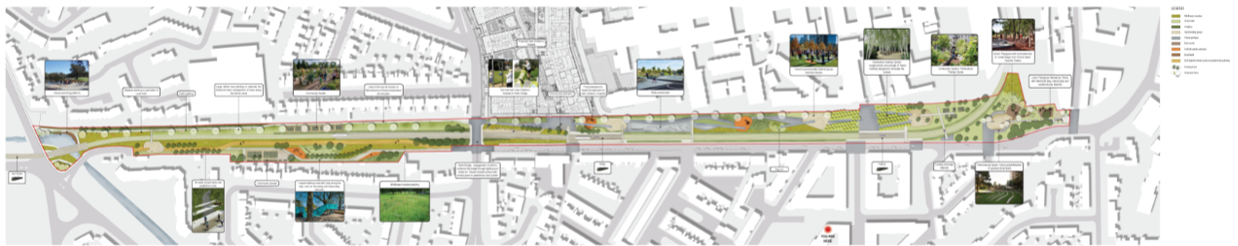 |
Dublin City Council Parks & Landscape Services have, in recent months, been developing a conceptual landscape master plan for St James’s Linear Park (Brandon Terrace to Rialto Bridge & Rialto Bridge to Suir Road Bridge). Two public consultation workshops were held on Thursday 13th September 2018 in the F2 Centre, Rialto, in order to offer the local community and active stakeholders an opportunity to give their input and make suggestions for improvements to the park.
The results from the workshops held in September 2018 have been collated and analysed and are presented below.
Written submissions/comments to linearpark@ait-place.ie
Plan by section
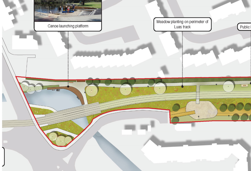 |
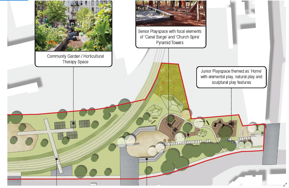
Suir Road End The major activity here is the proposed development of the Canal Elbow into a kayaking resource. To service the proposed resource maybe the DCC Liffey Boat Club sports officers could establish it as an "outreach" water sports outlet here to service the local communities and schools. |
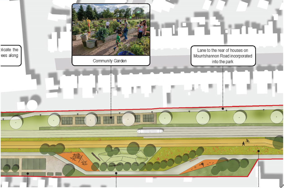 |
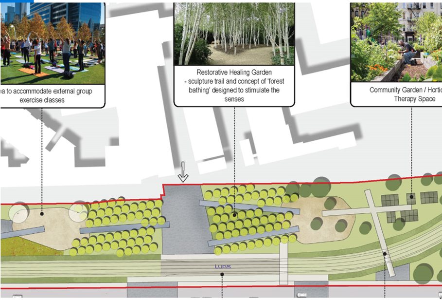
Mountshannon; there appears to be few places to stop and sit, the major feature of this stretch is putting another route to the north of the park along the rear of Mountshannon Road. To date, this section has been fenced off with access to rear of houses, here it is proposed to make it a pubic way. To the west of this view a large section of the park runs against the side of the current OPW warehouse, it would be logical to look at the future use of this site in terms of it interfacing with the park . A community garden or allotments? |
 |
Rialto Bridge ; It has been suggested that that traffic lights operate on both sides of the bridge thereby making the entire bridge a pedestrian zone on a red light, this not only has the effect of joining the bridge with the park but also allows for potential dual access to the park on either side of the bridge. The surface of the bridge could also be "modified" to blend in more with the surfacing of the park |
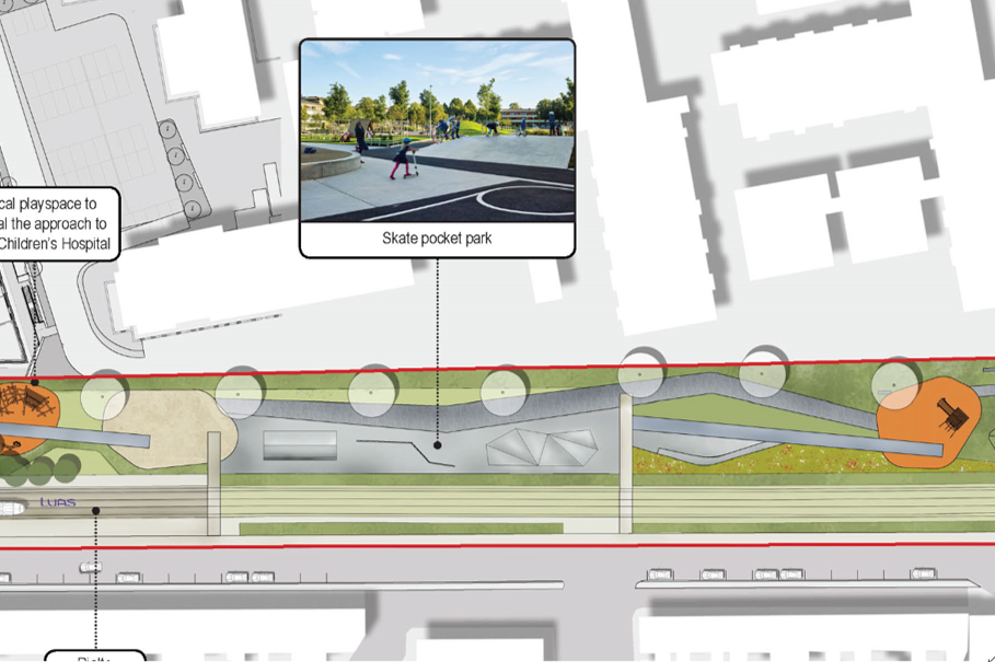 |
Luas James Walk , it is not clear where the pedestrian and cycle ways go along this section which envisages high levels of youth activity on skateboards . |
 |
Fatima |
 |
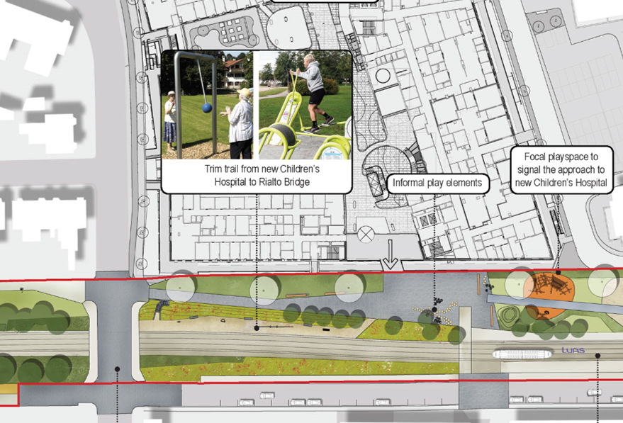
Basin Lane : The Basin Lane abuts a number of high walls along the north side. Beyond the walls are the playgrounds of the primary schools. Is there a way in which the walls could become more permeable, in many cases it is the same children playing on either side of the walls? Further to the east how will the park connect with the proposed new James's Day Hospital, that expect many of it's visitors walking to it from the LUAS Stop. |